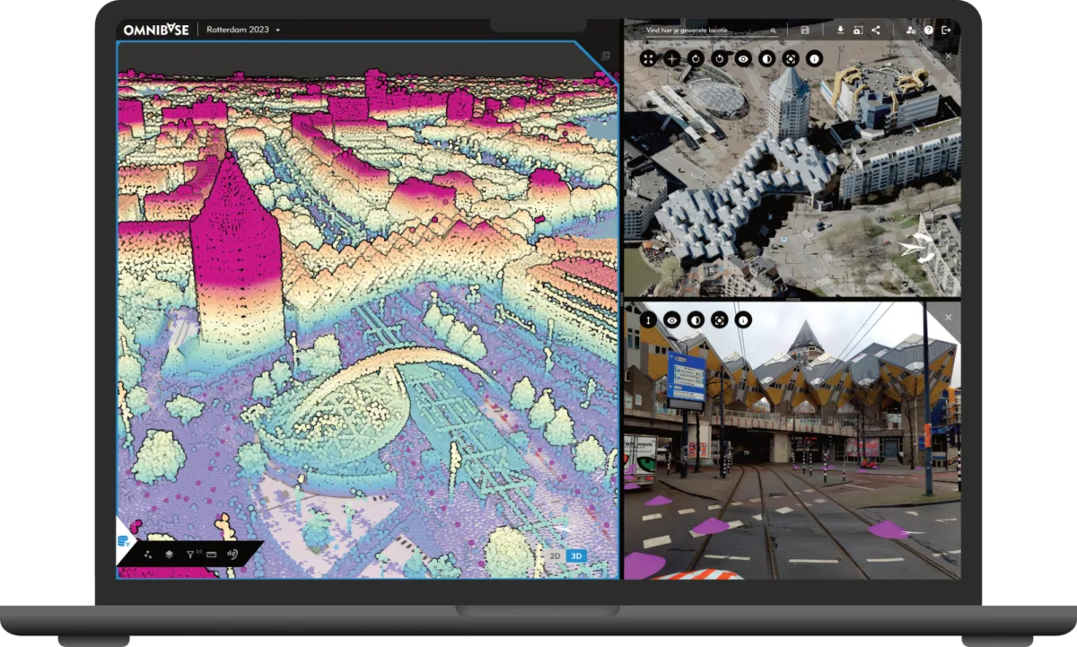
All imagery and 3D data within reach
Point clouds, nadir and oblique photos, panoramic images, and 3D-models are all available in Omnibase. You can easily switch between datasets and different acquisition moments to analyze objects and areas. In addition, all datasets can be used within the same measurement.
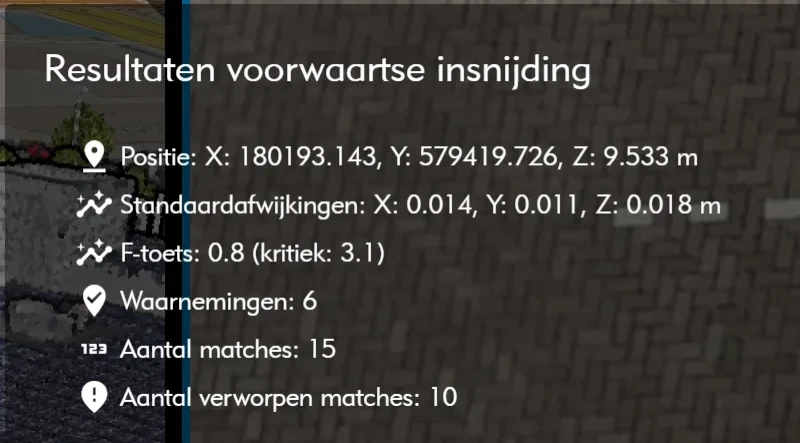
Because quality matters
Omnibase ensures that measurements comply with standards and best practices from the fields of surveying, photogrammetry, and laser scanning. For photogrammetric measurements, you can, for example, review the adjustment results of an automatic measurement before approving them.
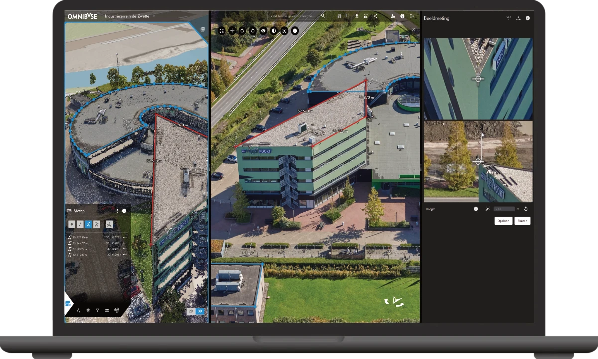
Measurements without boundaries
Every dataset has its advantages. In Omnibase, you don't have to choose between oblique photos, nadir photos, panoramic images, 3D-models, or point clouds. Combine all datasets within one measurement. Start in a point cloud, continue in an oblique image, and complete your measurement in a panoramic image: measurements are displayed live in all open (split)screens.